Korea Land and Geospatial Informatics Corporation

We combined high-precision image capture, multi-UAV control and mission data processing to support the digitalization of cadastral resurvey and geospatial information work.

About the customer

Carrying out national land information and cadastral projects

The cadastre is the national base record of all land information and its changes. The Korea Land and Geospatial Informatics Corporation carries out cadastral and geospatial information projects, has promoted quality control for roads, railways and underground facilities and the digitalization of paper cadastral maps, and had operated multiple UAVs for several years to acquire high-precision imagery.

Challenge

The limits of one-to-one piloting, communication loss and manual data transfer had to be reduced

Existing drone operations relied on one-to-one piloting over RF and Wi-Fi, which limited responses to emergencies such as collisions with terrain or structures, crashes and loss of communication. Repeating the same task with a single drone lowered efficiency, and manually moving images stored on SD cards increased processing time. With concerns about information leakage from imported commercial drones, domestic multi-UAV operating technology and a real-time data processing environment were needed.
Solution

We developed online and offline GCS, multi-UAV control and a high-precision imaging mission service

The 2021 R&D project was carried out by a consortium of UMAC Air, the Korea Electronics Technology Institute and SyncTechno. UMAC Air was responsible for UAV hardware, the Korea Electronics Technology Institute for the onboard mission computer, and SyncTechno for the online and offline ground control systems, multi-UAV control and the mission service system.

  1. 01RF and LTE communication integration

    Linked with an LTE-based mission computer, we set up an operating environment in which RF and mobile networks can be used selectively in emergencies.

  2. 02Multi-UAV control

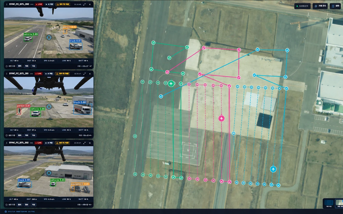
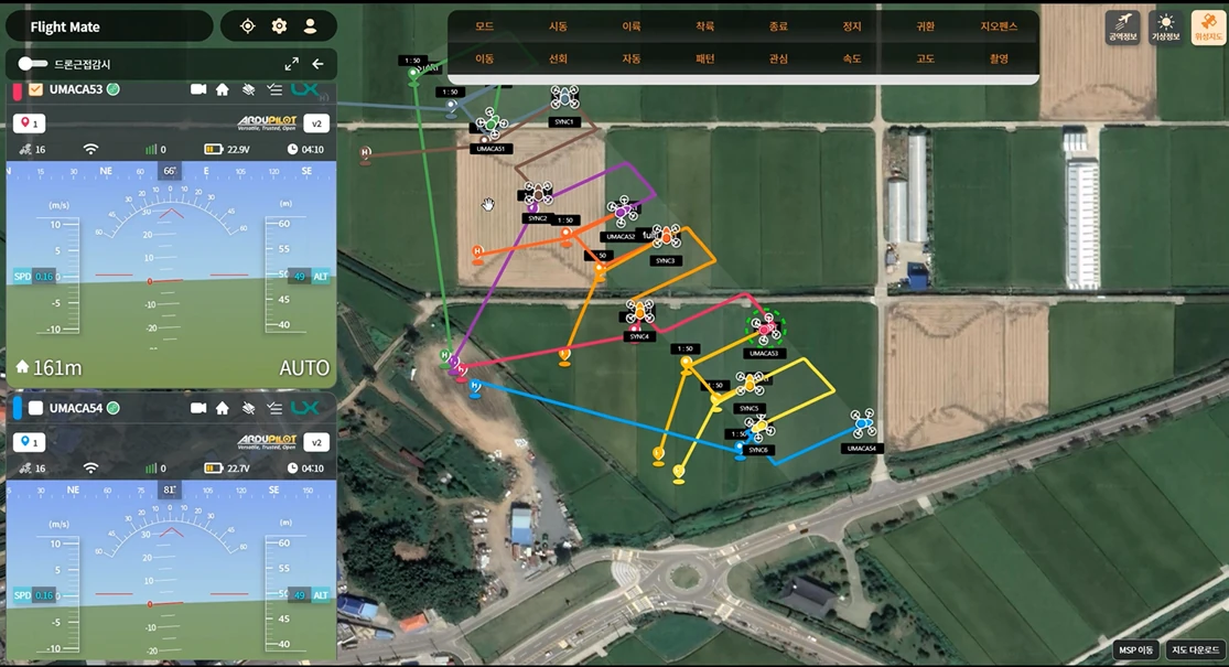
    We developed an integrated online and offline GCS for controlling multiple UAVs simultaneously and viewing real-time video.

  3. 03High-precision imaging mission management

    The system checks photo quality, location and overlap, and manages the acquisition, preprocessing, loss prevention and transmission of flight data and high-precision images.

Video

Project Results Video

This video shows how multiple UAVs are operated in a single environment, with the status information and data required for control and mission execution managed together.

Key features

Installed GCS

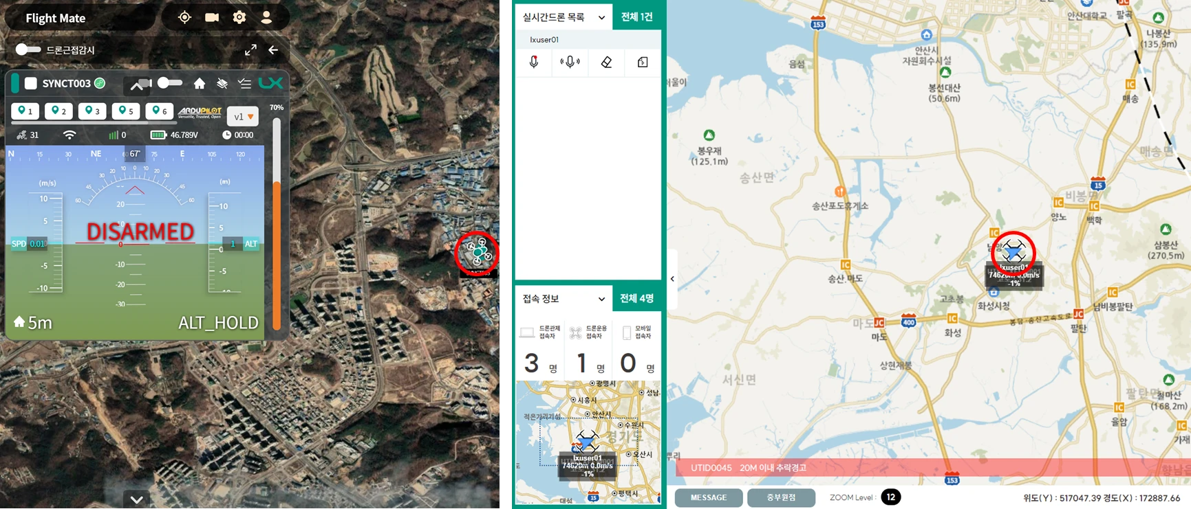
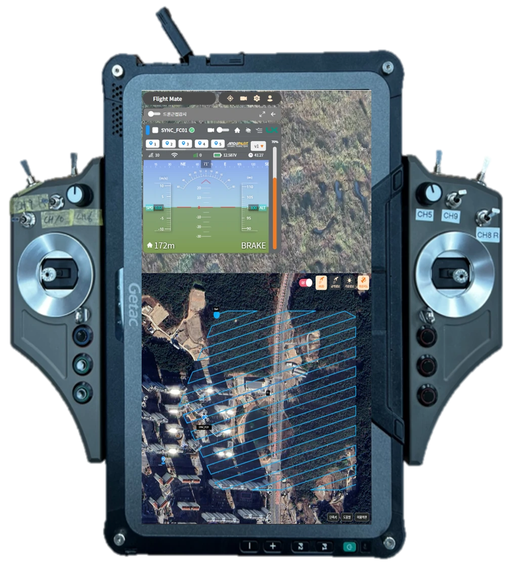
An installed GCS program that can be loaded onto the controllers of UAV hardware manufacturers. Where internet connectivity is poor, it communicates directly with the aircraft over RF channels and uses offline map data caching to carry out missions.

  • Automatic generation of imaging flight paths, flight distance, estimated time and capture interval
  • Choice of satellite or standard maps and flight plan management
  • Real-time review of mission images and import/export of recurring routes
  • Application of oneM2M-based technology
  • Detection of unregistered drones and collision avoidance
  • Map data caching and direct RF communication for areas with unstable internet
DX-Sky installed GCS
Key features

Web-Based Integrated Control

A platform for registering, managing, planning flights for and controlling multiple internet-connected drones in a single cloud-based environment.

  • Drone device and user management
  • Display of airspace and weather information
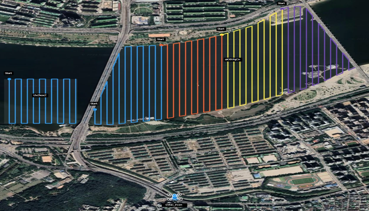
  • Imaging route design and assignment for multiple aircraft
  • Real-time review of mission images
  • Detection of unregistered drones and collision avoidance
  • Import and export of frequently used flight paths
  • Application of oneM2M-based technology
DX-Sky web-based integrated control
Key features

Mission Integration Framework

Integrates data collected during missions with organizational systems so that flight and mission data can be put to use.

  • Mission list management and location validation
  • Mission data selection and download
  • Captured image review and map integration
  • Overlap check for captured images
Mission Adapter
Key features

Managing everything from aircraft preparation to flight logs in one operating system.

  1. 01Registration and setup

    Configure aircraft pairing and site, RTK and payload profiles.

  2. 02Mission design

    Manage area and corridor surveys and recurring missions in a library.

  3. 03Control and logging

    Review video, telemetry, flight events and sortie history together.

  4. 04Diagnostics and recovery

    Reduce operational downtime through status checks, configuration deployment and field diagnostics.

Outcome

We implemented a geospatial data acquisition system combining domestic airframes, mission computers, GCS and mission services

Over the two-year project, three types of UAVs for high-precision imaging, a ground control unit, an LTE-based mission computer with multi-GCS, online integrated control, data processing software and a cadastral resurvey mission service platform were developed. Multi-UAV operation, including simultaneous operation of up to ten aircraft with real-time video control, was validated, and K-Mark and GS certification strengthened the competitiveness of domestic technology.