Korea Aerospace Research Institute

We gather video and flight information from multiple unmanned vehicles on the ground and connect it to map-based analysis and AI object detection in a single environment.

About the customer

Researching aerospace and unmanned vehicle technologies

The Korea Aerospace Research Institute is a national research institute that carries out R&D in aerospace fields including aircraft, satellites, launch vehicles and unmanned vehicles. In the unmanned vehicle field, it researches technologies that let aerial, ground and maritime vehicles communicate directly and cooperate, and carry out missions without human intervention through autonomous intelligent swarm operations.

Challenge

Video and tag information captured by different unmanned vehicles had to be gathered and analyzed on the ground in real time

Fixed CCTV cameras have limited angles and coverage, whereas drones can capture wide areas in three-dimensional space, which is advantageous for object detection. The Korea Aerospace Research Institute needed a system that collects camera video from multiple unmanned vehicles, analyzes it on the ground and connects it to tag information from mission equipment and AI-based object detection. A separate communication environment that does not depend on fixed communication infrastructure was also required.

Key features

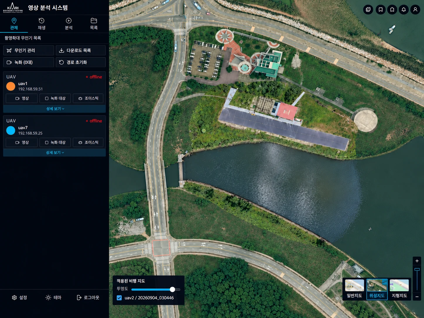
The ground system shows vehicle status together with video, paths and capture coverage.

  1. Real-time vehicle control

    Shows position, altitude, speed and gimbal status for each vehicle and up to three live video streams. Several vehicles can be selected and recorded at once.

  2. Path and coverage playback

    Displays travel paths and capture coverage on the map, and plays video from multiple flights together on the same timeline.

  3. Mission data management

    Stores, searches and downloads video, images, sorties and trajectory data, and connects ROS2 and MAVLink-based vehicle channels with the ground system.

  4. Target designation and tracking

    Designate a target on the live video and the gimbal follows it, with target status and position managed in a list.

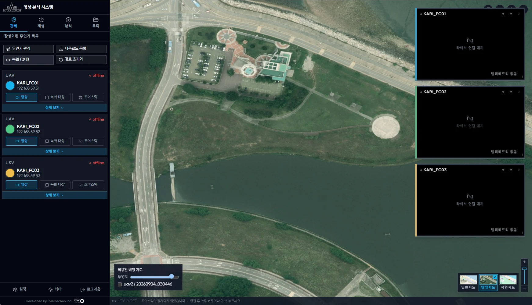
UAV control map based on an aligned orthoimage
AI analysis screen showing person detection results and estimated map positions
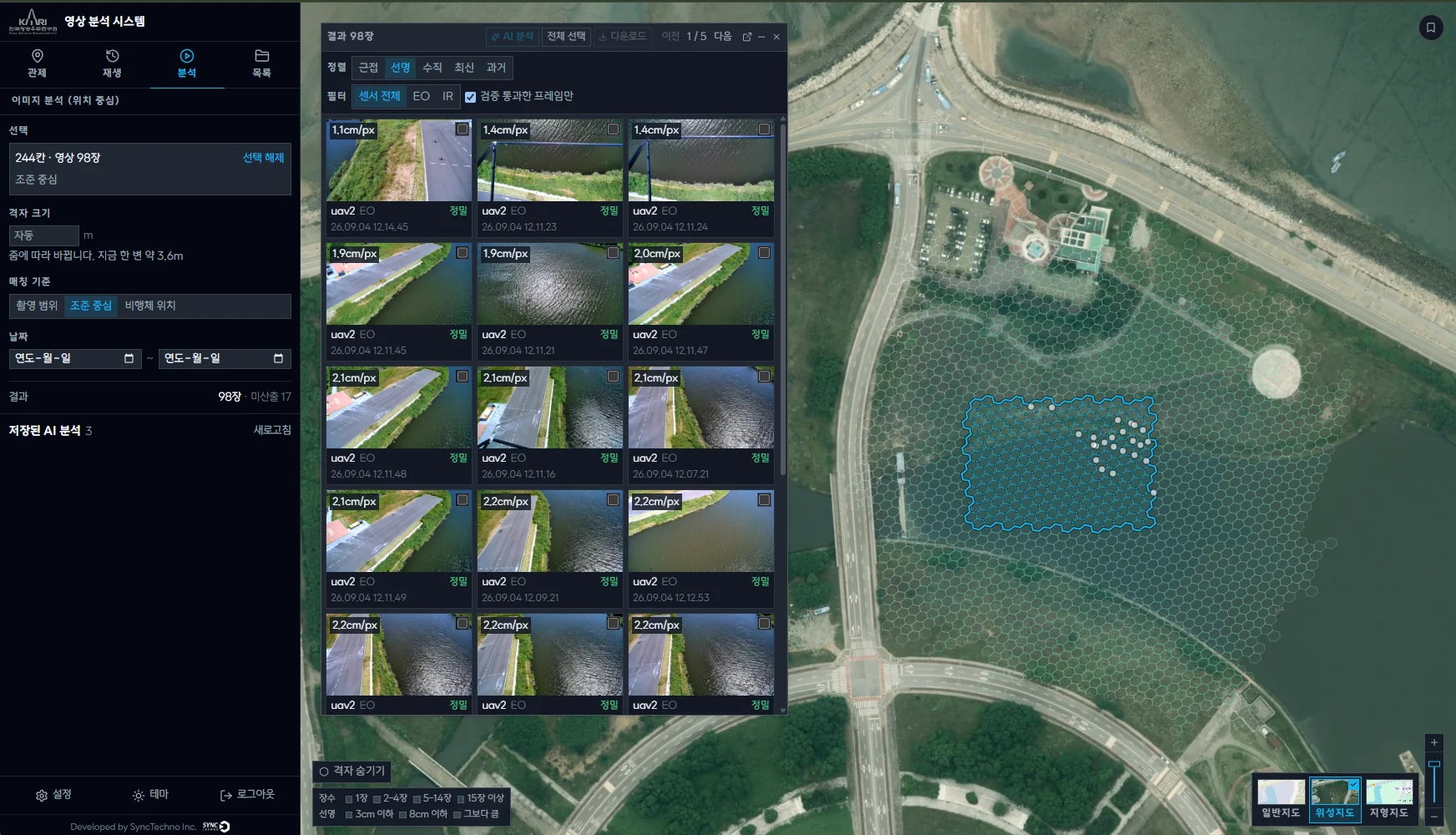
Analysis screen that groups capture locations into a hexagonal grid to search imagery
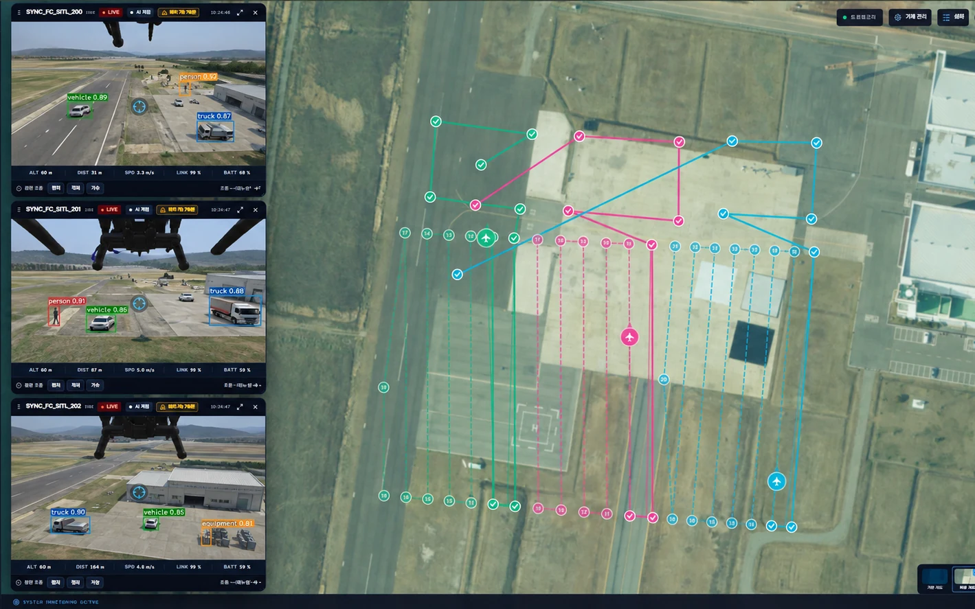
Control screen showing the status and live video of multiple vehicles in one view
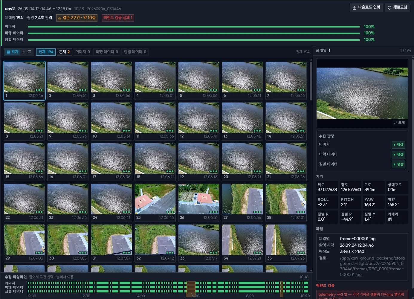
Screen for checking video, flight and gimbal data collection frame by frame
Solution

We record video and flight data as one, and connect control, analysis and AI object detection in a single environment

SyncTechno built a system that records and retrieves video and flight data per flight (sortie) from the vehicle, and links map-based control, analysis and AI object detection on the ground in a single environment.

  1. 01Recording and synchronizing video and flight data

    Video is recorded together with position, attitude and gimbal data, and the timestamps are aligned so every frame carries its location. Data brought in by USB from sites with poor connectivity is processed the same way.

  2. 02EO/IR payloads and gimbal control

    Different cameras and gimbals are operated from one piece of software, and EO/IR switching, zoom, point-at-coordinate and target tracking are controlled from the ground.

  3. 03GIS-based analysis and orthomaps

    Capture locations and coverage can be searched on the map, and video from multiple flights is turned into an orthomap exported as GeoTIFF or KMZ.

  4. 04AI object detection and location estimation

    An object detection model finds objects in the video, and capture information is used to estimate their positions on the map. Results can be exported as JSON or GeoJSON.

Outcome

Video and flight data collected in the field became information ready for map analysis and AI object detection

By managing video, location, time and tag information together, we established a foundation for viewing information collected by multiple unmanned vehicles in an integrated way on the ground and using it for further analysis.